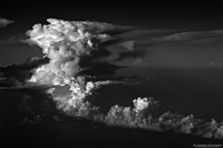
Tumult in the Troposphere
Most of my time in the sky, of late, has been spent avoiding thunderstorms and high intensity precipitation…it’s still Summer, so this is the name of the game. The funny thing about thunderstorms is that, for all their beauty, they are dangerous living things…they start out as soft billowy cumulous clouds and as they gather radiant energy and rising water vapor condenses, they grow up and take on their mature form. While on their way up, they are volatile and turbulent. As their growth comes in spurts, they flatten and expand with each invisible boundary they encounter until the latent heat released by the condensing vapor provides enough energy to continue their upward momentum toward the Tropopause and their natural limit. While this storm is off the Florida coast and tops out at about 45,000 feet (note: this photo is from 38,000 feet), closer to the equator, the Tropopause is higher and storms may reach closer to 60,000 feet. We look for the direction of the “anvil top” that blows off downwind from the cell and fly upwind when possible…Not only is the ride rough in the turbulent shadow of the storm, but nasty stuff like hail can be thrown downwind as far as 50 miles…the ride is smoother upwind and we all like that. In broad daylight, the danger of these cells is somewhat insidious as they don’t look threatening until you get up close…at night, we can see the lightening and the danger is more obvious…In the black and white photograph, the tumult of the cumulonimbus cloud appears more dramatic and its nature is better revealed.

