The Aerial Horizon
Forget where your feet are and simply enjoy the view.
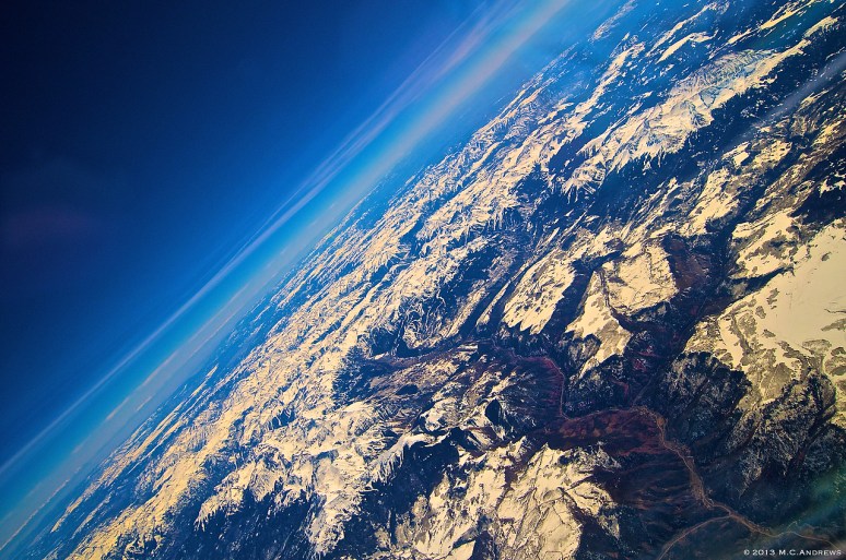
In the San Juan Mountains of Colorado, the San Miguel River leads our eyes toward the airport and city of Telluride.

Flying south of Sedona, the red striping of the deep canyon walls adds drama to the landscape while Mount Humphreys, the highest point in Arizona, recesses into the horizon.

Early morning departures racing toward “Charlie West.” Once a funnel for glacial movement down the continent, the mountains of West Virginia mark the beginning of our westward journey across the continent.

Flying through a cirrus layer above Lake Michigan, a sun dog develops…first a glimpse of refracted light like a spot of rainbow, then the rays extend vertically upward before visually curving into a ring around the sun. Meanwhile, two jets pass overhead; their contrails illuminated by the setting sun.
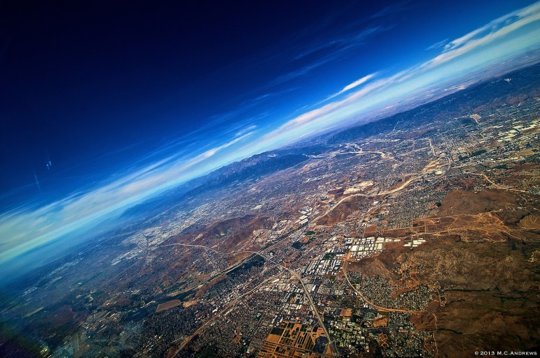
East of Los Angeles…One of the most interesting an beautiful things about Southern California is the use of space. Nearly every level piece of earth is covered with luminous geometric shapes fitting into odd shaped and sized bits of the landscape. Constrained and constructed yet naturally interrupted by outcroppings of rock, hills, and mountains.

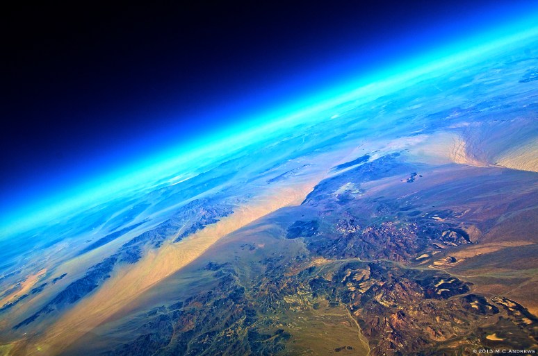
Southwest of Lake Meade in Nevada the contours and colors of the mountains, desert, water and snow bring schoolhouse topographical maps to life in ways unimagined. As the high cloud layer parts above the scene, the blue above guides us to the aerial horizon.

Approaching the Great Salt Lake from the west, sunlight reflects off the still waters broken by snow and ice.

Lake Havasu City, Arizona appears as a lone geometric shape amid the irregular landscape of western Arizona. With its coastline blending into the scene, it looks across the water to the Chemehuevi Mountains Wilderness Area on the edge of the Mojave.
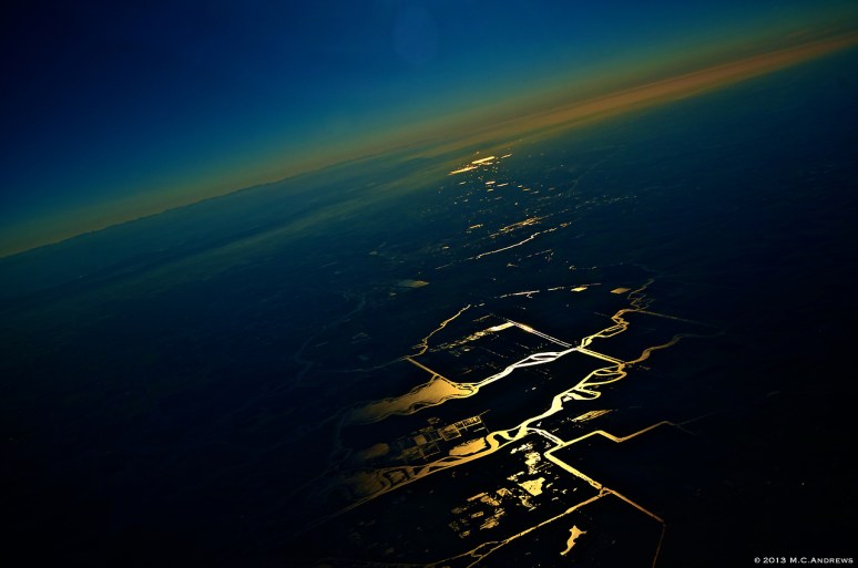
Flying northeast between Antioch and Stockton, California. Light reflects off waterways outlining Bacon and Woodward Islands creating golden pathways into the rich agricultural landscape of California.

Smokestacks along Lake Erie. Steam drifts toward Cleveland while its shadow floats on the lake.

Ottawa, Canada beginning to glow as the warm Spring sunrise strikes the buildings downtown and reflects off the fresh fallen snow.

Cloudbows are a common site from the cockpit. These are often centered around the aircraft’s shadow on the cloud top. This cloud bow was witnessed a few hundred miles southwest of Atlanta, GA.

Blanca Peak on the western ridge of the Sangre de Cristo Mountains in Colorado overlooks Fort Garland, CO and New Mexico to the south.
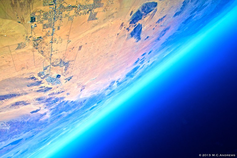
Approaching Twenty-Nine Palms, the desert rolls away and mountains begin to consume the horizon. Life etched out of sand in orderly lines.

The twilight zone… The line of shadow that separates night from day is referred to as a “terminator.” This is where twilight exists and where the purple hue of the earth’s penumbral shadow is visible as it is cast upon the sky. Photo taken over Texarkana.
The Mojave desert provides a colorful and dynamic landscape to prepare us for the majestic hills of California. Barren, windswept, worn and yet beautiful.

Blurring lights of southern Louisiana slip past while the steady glow of the western sky reminds us of the vastness of the universe. Orion, Taurus and the Pleiades hover over the aerial horizon.

Johns Canyon, Utah lies east of Lake Powell. The deep orange canyon walls zigzag and break up the landscape as anticipation grows for the overflight of the Grand Canyon to the southwest.
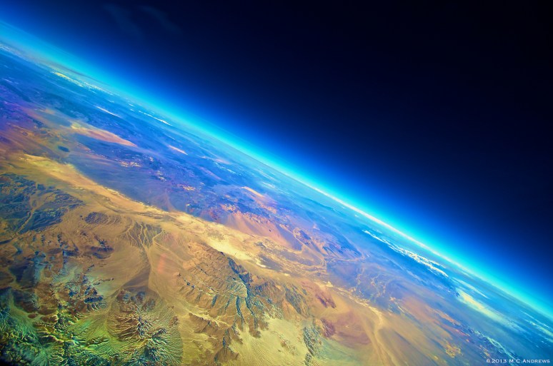
The Nevada desert, east of the Sierras and northeast of Death Valley, reveals a multitude of colors in its features.
The Aerial Horizon – Photography

